The Enchanting Far South of Madagascar
The Spiritual Values of Ancestral Worship
If you are looking to experience a rare and mythical journey, the crossing between Tulear and Fort Dauphin on the coast is part of these extraordinary crossings that we would like to share with you. This 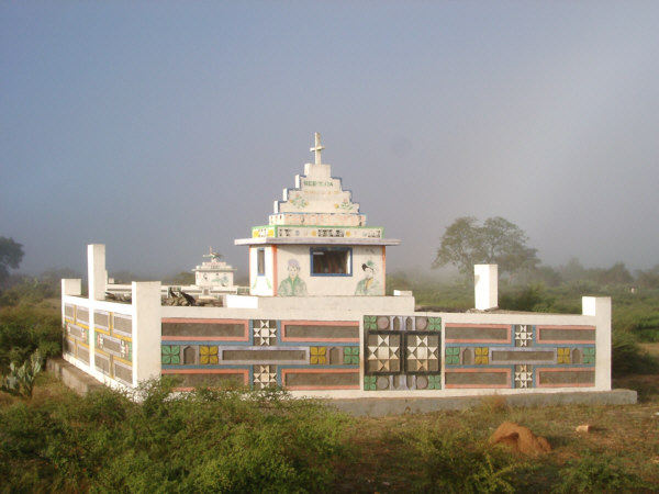 unique travel route takes you on the unusual and secret tracks of the far south of Madagascar, and the encounters in these remote regions are authentic, often picturesque, and deeply human. The vast Dunes of Androka, undulating as far as the eye can see, are a sight to behold.
The eye reaches as far as the Aloalo and tomb art of the Mahafaly, who specialize in it. These works, so characteristic of the region, symbolize the earth and the sky, the real and the imaginary, as well as the ancestors and the living. The Aloalo holds great spiritual value and is one of the fundamental pillars of Mahafaly culture.
As travelers, we are invited to respectfully approach the sacred and timeless. In the past, these burial sites were hidden, secret, and only a few had access to them. Unfortunately, this is no longer the case today. Our role also includes being respectful and appreciative of these sacred sites. Encouraging people to respect these places and not to trade with these pieces that have a very high symbolic value is essential. Continuing our journey, crossing the Menarandra River is already a unique adventure in itself. The dry bed leads us into the territory of the Antandroy ethnic group.
Transition from the dry south to the lush vegetation of the east
This very dry region is difficult to cultivate, and the population mainly relies on extensive sheep and cattle farming. We pass through forests of cactus trees with sharp thorns, leaving lasting memories on the sides of the Toyota.
On the ground, Among the pebbles of the 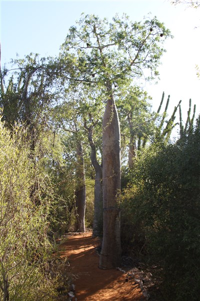 path, vigilance is required: magnificent Radiated Tortoises, endemic to the south of Madagascar, move nonchalantly. Undoubtedly, we are in the heart of the “Land of Thorns”, the driest region of Madagascar. The various species of Didiereaceae are there to testify to this.
Gradually, the vegetation and environment change. At the height of the Andohahela Reserve, three specific biotope types converge: the dry bush, the semi-dry forest, and a dense, humid forest that. South of the Tropic of Capricorn is rather rare. A little further east, the transition is sudden. We cross a ridge under magnificent, extravagant trees, and in front of us opens up a wide, green valley.
Fort Dauphin or Taolagnaro
The Anosy Region marks the transition to a new natural and human environment. Here, mountains flow into the sea, mighty rivers flood the landscape before reaching the Indian Ocean. Every time we travel, we feel the same feeling in front of these elements, an incredible feeling of silent strength. Fort-Dauphin or Tolagnaro is located at the foot of Pic Saint Louis, facing the Indian Ocean. The tranquility of this provincial town is soothing, perfect for a healthy recovery after this beautiful escape. We are located 1,122 km as the crow flies from Tana, the capital in the highlands.