Discover the Beauty of Pangalan Canal in Madagascar – A Hidden Gem

Discover the Pangalanes Canal, the longest waterway in the world with a diverse history. Learn about this pharaonic masterpiece and its significance in Madagascar. Explore the famous Canal des Pangalanes and its intriguing past.
Pangalan Kanal

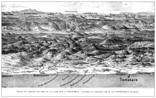
Pangalan Canal, the longest waterway in the world

The diverse history of this pharaonic structure

I want to take the suggestion of a good friend as an opportunity to write about the famous “Canal des Pangalanes”. While I almost always agree with my friend on matters concerning the red island, when he says that this “pharaonic structure” has been forgotten, I have to disagree.

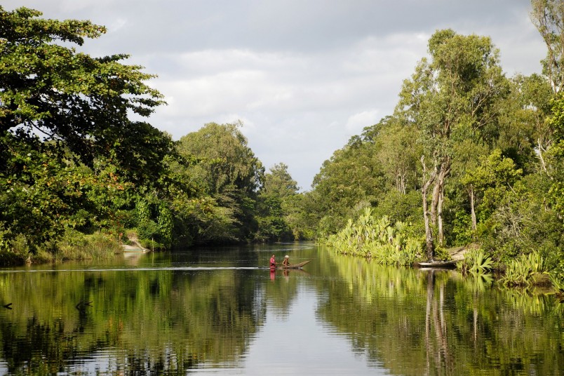
If you are interested in exploring the mysterious Canal des Pangalanes in Madagascar, you will find plenty of colorful stories and local legends to immerse yourself in. While there is limited literature available in German about this impressive waterway, it is definitely worth discovering. In recent years, many sports enthusiasts have taken advantage of boat tours organized by local hoteliers and tour operators along different sections of the canal. Despite the challenges the canal has faced over the years, a boat tour through the mountain cloud forest, for example, is still a rewarding experience. Explore more about it here.

Kanal Pangalanes

The Longest Waterway in the World

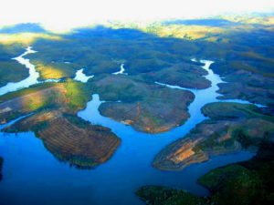
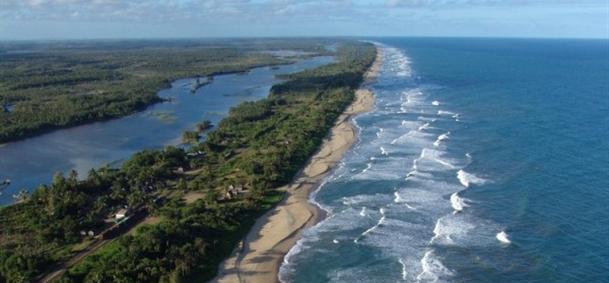
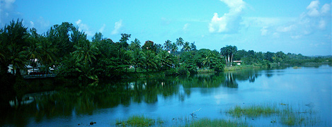
The Pangalanes Canal is the longest and perhaps the most unknown canal in the world. While its famous counterparts like the Suez Canal stretch over 165km and the Panama Canal over 80km, the Pangalanes measures a proud length of 645km. Its northern endpoint is Tamatáve or Toamasina, the major port city on the east coast. The southern point is located at…

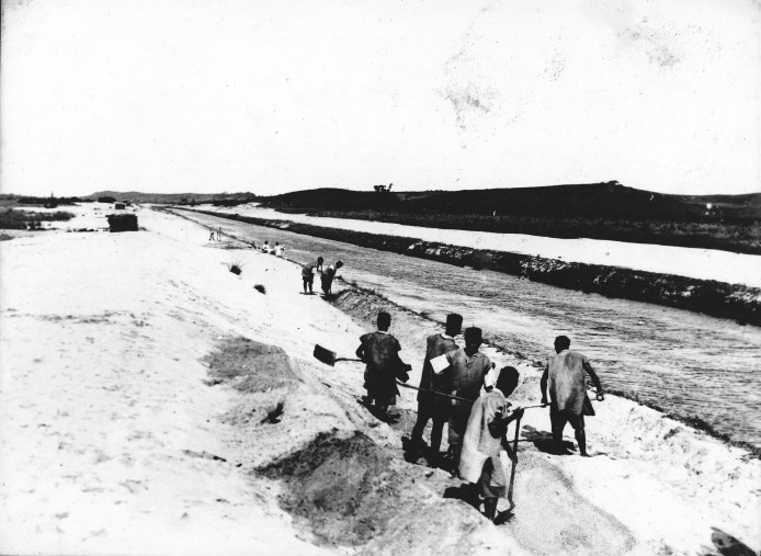
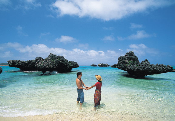
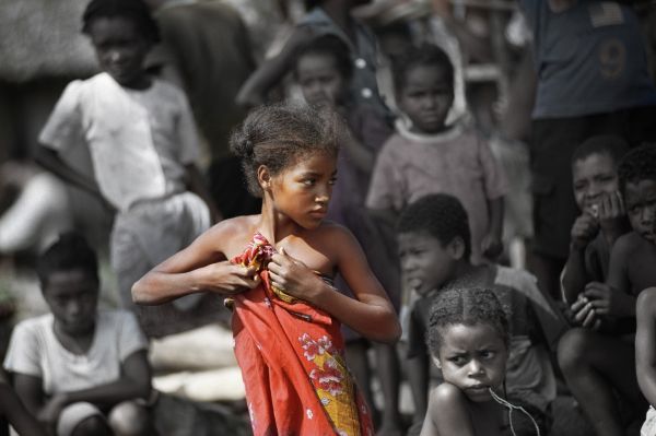
Farafangana is a coastal town in Madagascar, located parallel to the coastline with a distance of only 100 meters from the sea. The canal cleverly follows the natural course of lakes and rivers fed by water from the forested highlands. Through artificially created side canals, it connects to the next water body. The coastal communities in this area have a long history of intensive agriculture, producing valuable commodities such as coffee, cocoa, vanilla, coconut, and spices. Learn more about coffee, cocoa, and vanilla in Madagascar. Vanilla is still grown here today and can be purchased, for example, during a 4-day tour to the heart of the Sava region. The Canal des Pangalanes is still an important transportation route on Madagascar, as there are few paved roads on the island. This canal allows people to not only provide goods for their own use, but also for trade. Built during the French colonization period, France played a significant role in developing the island’s infrastructure. There are roughly three distinct phases of construction for the Canal des Pangalanes.

The First Phase: Annexation and “Pacification” of the Country and the Development of the Pangalan Canal

When the French Parliament decided to annex Madagascar at the end of the 19th century, the occupiers began by “pacifying” the country. The previous French-Malagasy wars were characterized by the French mainly using brutal military force. The fact that the Malagasy people had little to resist the Europeans’ weapons proves that

The decline of the Merina monarchy. Although the Malagasy people could not organize a unified resistance, the “pacification” of the country lasted a full eight years. Eight years during which the then Governor Gallieni brutally suppressed the protests of the Malagasy against their colonial rulers. Countless villages were destroyed and to this day, the exact number of indigenous Malagasy who fell victim to the “pacification” of the country remains unknown. Estimates suggest more than 200,000 fatalities.

Due to the high costs incurred by the extensive use of military and colonial administration, the occupiers quickly sought ways to profit economically from the colony. Since The fertile East Coast region, with its natural resources as mentioned above, urgently needed connection to an infrastructure. A canal seemed to be the simplest and most sensible solution, meeting the interests of the occupiers: goods and products could be shipped along the East Coast, and military contingents could be quickly moved through the waterway to suppress resistant coastal residents with force or tax demands. The canal is therefore the earliest evidence of Madagascar’s economic exploitation. Built with tremendous effort between 1896 and 1904, the canal was the most expensive French colonial project up to that point. The construction of the railway was even more expensive than the famous “Yünnan Railway” in Indochina, which had cost 20 million gold francs. Excavating the wet, impassable terrain required hordes of forced laborers and countless casualties.

Pangalan Canal

The Second Phase: Building the Railway

During World War I, France initially turned its attention away from the colonies. and instead focus on the battlefields of Europe. With the end of the World War and the reparations promised to France by the Treaty of Versailles, the French government was able to once again expand its administrative influence over the colony and reap economic benefits from overseas territories. The construction of the Madagascar railway falls into this second phase: the railway line from Antananarivo to Antsirabe connected the fertile “vegetable garden” of Madagascar with the capital, while the almost simultaneous construction of the route from Antananarivo to Tamatave secured continuous transport from the central highlands to the main port on the east coast. With the railway, which was then built, the colony experienced a period of economic growth and development. The Pangalanes Canal, stretching from the northwest of Lac Alaotra past the capital to the coast of Madagascar, was originally created as an important transportation route for rice and industrial raw materials. The construction of the railway from Fianarantsoa to Manakara in the 1920s further connected the highlands to the coast and the canal. This allowed for quick transportation of colonial goods to the ports for export. It was only with the completion of the railway lines that the Pangalanes Canal could unleash the economic potential envisioned by its builders.

The Third Phase: 1940-1960

After France was initially defeated by Germany during World War II in 1940, the so-called “Vichy Regime” was formed, which declared loyalty to Germany. The troops stationed in Madagascar also pledged allegiance to Vichy, leading to attacks on the colony by British naval and air forces. Fierce air, artillery, and naval battles raged around the city of Diego-Suarez in 1940, until the Vichy loyalist troops eventually surrendered. The British then handed over the island to the government of “Free France” under Charles de Gaulle. His post-war government… After 1945, Madagascar began to usher in the third phase of colonization: it was during those years that the construction of numerous airports, runways, and other aviation facilities began. In addition to military considerations, the needs of the many French settlers in the country were also at the center of the planning. Finally, in 1960, Madagascar achieved its long-awaited independence.

The Pangalan Channel Today

Over 50 years have passed since Madagascar gained independence, and much of the colonial infrastructure in the country now exists only in meager remnants. Efforts are being made to maintain and even renew the main road connections, known as “Routes Nationales,” established during the 2nd and 3rd phases of colonial history with the help of foreign aid. However, the number of regularly used airports is declining. The railway network is also stagnating, with only the rickety “FCE” from Fianarantsoa to Manakara still in existence. The railway connection between Antananarivo and Antsirabe has been renovated, but the overall state of transportation infrastructure in Madagascar remains a challenge.

Although the hopes of putting this important route back into operation were dashed in 2009 with the takeover of the coup leader Rajoelina and the subsequent 2009 political crisis, it is now ready for operation.

Similarly, on the old route from Antananarivo to Tamatave, passenger traffic is either impossible or limited: Very rarely do freight trains travel from the capital to the coast. Passenger traffic only begins from Moramanga. The railway line from Moramanga to Ambatondrazaka on Lake Alaotra is currently operational, but it is only a matter of time before this mode of transportation is also discontinued due to corruption-related underfunding. Along the RN7, however, there is still the possibility of traveling. Today, you can take a train ride to Manakara that guarantees passengers a breathtaking view of stunning landscapes.

The Pangalanes Canal is no exception to the examples of decay: due to severe weather changes, storm surges, floods, and other environmental influences, the course of the “Pangalanes” has not always been easy. For a long time, efforts were made to keep the secondary canals clear and enable water traffic as much as possible. However, serious signs of silting of this magnificent structure are now evident: passage to Farafangana on the canal has not been possible for years, and even in the northern part, it is only Still navigable on small sections, most of the intermediate parts have become impassable. The longest canal in the world, once a symbol of civilization and economic efficiency, is now silting up in tropical stagnation.

Explore more about Madagascar