The Antandroy People in Madagascar
The region of Androy stretches between the Menarandra River in the west and the first foothills of the Anosy River in the east. Except for the deep Mandrare, which has been developed since the 1930s with extensive industrial sisal plantations, the vegetation of Androy resembles that of a subarid region.
In the lower Androy (south), which is very dry, the quaternary marine limestone or dune sandstone remains the domain of bush and steppe, while in the upper Androy (north), which is wetter, 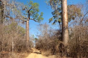
The crystalline underground and the land of volcanic origin favor a wooded savanna.
Paradoxically, the south is more densely populated than the north, but everything is relative: just over ten inhabitants per square kilometer…
The route of the RN 10, from Beloha to Amboasary, via Tsihombe and Ambovombe (toponyms that mark the socio-religious preeminence of cattle breeding, Omby (“Zebu”), more or less follows the border between the two Androys.
Although drought prevails in this southern region most of the year, the storms of the dry season (December – April) and the Mediterranean showers in July can offer unpleasant surprises for drivers by causing floods.
Several sections of the national road turn into swamps for several days.
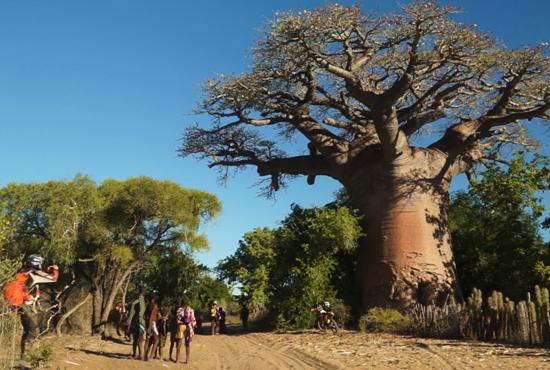
Androy, the Land of Thorns
Three shrubs are dear to the Antandroj: the
Fantsiholitra (Alluaudia procera), the Roy (Mimosa delicatula), a thorny tree that gave the region and its inhabitants its name, and the Raketa (Opuntia dillenii) or prickly pear.
Introduced in the 18th century by the Count of Modave in the south of Madagascar, the Raketa once covered vast areas and was a true godsend in times of famine. The figs fed. Meaning.
The men and the leaves, freed from their thorns by a passage through the fire, provided food for the animals.
By using these fleshy and thorny plants to create practically impenetrable hedges around their villages, the Antandroy people were able to resist French colonization until 1905.
However, in the 1920s, on the advice of botanist Perrier de la Bathie, the French introduced a pest that destroyed almost all prickly pear trees within a few months, triggering a catastrophic famine.
In this country, where cattle and goat farming is combined with a sparse food-producing agriculture, the issue of water remains crucial.
Importance.
Rivers are usually irregular, so brackish water must be easily taken from the holes dug and deepened daily in the sand. At the end of the dry season, people line up at the edge of the only and last “well” painstakingly maintained and dug by the whole village. These vovo (water holes) are more than providential…
To paraphrase Jean Féniès, the former colonial administrator, “Drought determines human evaporation”. Following a long tradition, the Antandroy people, when it comes to survival, leave their village to settle in Toliara
The miners have built their straw huts on a hill, and in the courtyard of each of them, women sort through the dense blue stones by studying them in the sunlight.
Betanty (30 km south of Tsihombe, on a well-maintained road with graves). Betanty owes its former name “False Cape” to Portuguese cartographers who, five centuries ago, mistook the location for the southern tip of Madagascar, actually Tanjona Vohimena (Cape Sainte-Marie).
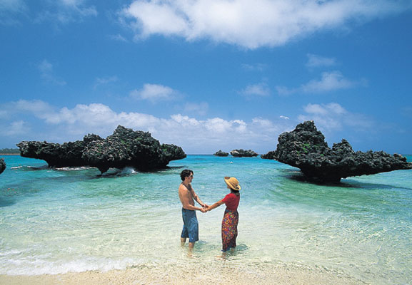
Its long sandy beach and very safe lagoon have made Betanty a pleasant little holiday resort.
You can buy beautiful lobsters from the fishermen. Embark on pirogue trips in the lagoon – and observe the passing whales from April to November – and go on hikes to Tanjona Vohimena (Cape Sainte-Marie) by bivouacking on the beaches.
Tanjona Vohimena (Cape Sainte-Marie) 50 km southwest of Tsihombe, this place, battered by the winds and signaled by a decommissioned lighthouse, marks the southern tip of the island. Tanjona Vohimena has been established as a “special reserve.”
Ambovombe
(67 km east of Tsihombe). Ambovombe is the capital of Androy and an important transportation hub. Ambovombe is a lively city, especially on Mondays, market day. Throughout the week, craftsmen offer their goods in front of the. Buschtaxi-Station Antandroy: Hats, Rosewood, and Fine Stone Objects Available
Located in Amboasary-Sud (35 km northeast of Ambovombe), this small town in the lower Mandrare Valley is the center of a sisal-producing region and the market for sapphire mines in the Anosy mountain ranges. Since 1994, these mines have attracted miners and lapidaries from Taiwan, Thailand, Europe, and the United States.
To the east of the town, a metal bridge built by Gustave Eiffel’s company during colonial times spans the Mandrare River. This river, with a riverbed that can reach up to 400 meters wide in some places, carries turbulent waves during the rainy season.
[Image: Ilakaka4]
For more information, visit: [https://www.urlaub-auf-madagaskar.com/wp-content/uploads/2015/07/Ilakaka4-e1589635013105.jpg] During the dry season, it is reduced to large bodies of water where the villagers from the surrounding area come to wash their clothes.
Androy Museum, Berenty Reserve (5 km northwest of Amboasary)
A museum of Androy, called Arimbelo (“Coal of Life”), opened in 1995 in this private nature reserve of 265 hectares, a true oasis along the Mandradre river. Like the reserve, it was established on the initiative of planter and hotelier Jean de Heaulme.
In four rooms, the Antandrojs are presented in their environment, their daily life, especially through their crafts and the major ceremonies that characterize their existence, and the history of the region is traced through archaeological research.
The The museum also offers a reflection on the environment and development.
Renouveler. Les forges de Bekily et Bekitro étaient connues pour leur art de fabriquer des fusils en utilisant quelques pièces usées et usées.
Quand les autorités ont saisi les fusils, les guerriers ont remis des armes qui ne fonctionnaient pas et ont soigneusement caché les autres.
Jean Oberlé, Provinces Malgaches, 1979

